1st March 2009.
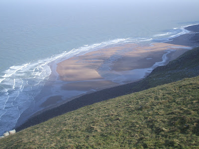
Not a bad day. The Metcheck forecast was indicating an UV rating of 5. I had not been out to the Ivystone for a while. The Ivystone is situated on the coast, about one and a half miles west of Porlock Weir. You can shorten the trudge along the beach by driving out to Worthy Combe where you can park at the tollgate for a very reasonable price. From here it is about a forty-minute walk. It is not well known but there is a path leading from the first tunnel on the coast path down through the woods, emerging on the beach at Rockford Cottage. It is very steep just above the ruin, great care is required to avoid finding ones self on the beach much quicker than intended. I have been told that Rockford Cottage was intended to be the home of the butler to Ava Lovelace of early computer fame who resided above at Ashley Combe House. His duties included receiving goods landed on the beach. Another version is that it was built so that the lady of the house could bathe in private. Either way there is still a cleared area for boats or swimming on the beach.
 Moving west the erosion of the cliffs continues until you past First Rocks. The wind was cold and from the west. I had done it yet again; I had come to the wrong place. The sun is not high enough yet to peek over the hill, the beach remained in shadow all day while over my shoulder I could see Hurlstone Point bathed in sunlight.
 I bashed on towards Culbone Rocks where the stream appeared to be in full flow. The thick rope a few yards to the west of the stream is still in place allowing the fit and strong to pull themselves up into the woods and on to Culbone. On arrival at The Ivystone I noticed a peregrine perched on the very top of the buttress seventy feet above the beach. The tides are quite high at the moment with low water being a long way out. Until Wednesday it should be possible to walk past the sixty-yard frontage of the buttress near or on low water. I played around for a while climbing across the lower part of St Bueno’s slab sheltered from the wind by the buttress. I then climbed to the top of the buttress via the path, which crosses the top of Bueno’s slab.
 I was shocked to find that the ridge that runs down on to the top of the buttress had shattered during the winter and the last few feet of the path was missing. Very carefully I crossed the debris on to the top of the buttress where the rock pinnacle is teetering above St Bueno’s slab.
 I would be surprised if it remains in place for much longer. The peregrine had flown leaving evidence of many pigeon meals on what is obviously its favourite spot. There are deer droppings on the buttress; they have been on the ridge and down the west side of the buttress to the beach. I climbed on the west side of the buttress on a route named Albatross until the tide receded allowing me to walk back to the east side where I had lunch at the foot of the slab out of the wind in the lee of the main buttress. I had a bag full of heavy climbing equipment. I did not feel like climbing up the ridge
 to the coast path so I retraced my steps back along the beach to Worthy Combe and the car.
It is very steep just above the ruin, great care is required to avoid finding ones self on the beach much quicker than intended. I have been told that Rockford Cottage was intended to be the home of the butler to Ava Lovelace of early computer fame who resided above at Ashley Combe House. His duties included receiving goods landed on the beach. Another version is that it was built so that the lady of the house could bathe in private. Either way there is still a cleared area for boats or swimming on the beach. Moving west the erosion of the cliffs continues until you past First Rocks. The wind was cold and from the west. I had done it yet again; I had come to the wrong place. The sun is not high enough yet to peek over the hill, the beach remained in shadow all day while over my shoulder I could see Hurlstone Point bathed in sunlight. I bashed on towards Culbone Rocks where the stream appeared to be in full flow. The thick rope a few yards to the west of the stream is still in place allowing the fit and strong to pull themselves up into the woods and on to Culbone. On arrival at The Ivystone I noticed a peregrine perched on the very top of the buttress seventy feet above the beach. The tides are quite high at the moment with low water being a long way out. Until Wednesday it should be possible to walk past the sixty-yard frontage of the buttress near or on low water. I played around for a while climbing across the lower part of St Bueno’s slab sheltered from the wind by the buttress. I then climbed to the top of the buttress via the path, which crosses the top of Bueno’s slab. I was shocked to find that the ridge that runs down on to the top of the buttress had shattered during the winter and the last few feet of the path was missing. Very carefully I crossed the debris on to the top of the buttress where the rock pinnacle is teetering above St Bueno’s slab. I would be surprised if it remains in place for much longer. The peregrine had flown leaving evidence of many pigeon meals on what is obviously its favourite spot. There are deer droppings on the buttress; they have been on the ridge and down the west side of the buttress to the beach. I climbed on the west side of the buttress on a route named Albatross until the tide receded allowing me to walk back to the east side where I had lunch at the foot of the slab out of the wind in the lee of the main buttress. I had a bag full of heavy climbing equipment. I did not feel like climbing up the ridge to the coast path so I retraced my steps back along the beach to Worthy Combe and the car. 
 The weather did not look promising to begin with. Low cloud was settling on the Quantocks and North Hill, with a chilly northwest wind at 1000ft.
 The sun eventually broke through allowing us to climb in shirtsleeves for most of the day. The air was really clear with views up to the Severn Bridge and way into The Brecon’s, where patches of snow could still be seen on the mountainside. Don’t know how much longer I can avoid paying the parking fee at Bossington, the climb back up to the car park on North Hill is taking a toll of a different kind.
 Didn’t know what to expect from the weather, the Brendons and the north side of Dunkery still had a fair bit of snow cover. A bad sign I am told if it lies about for too long.
 The Ravens are busy repairing their huge timber nests so maybe spring is not that far away. People are getting out again, there must have been well over twenty walking on Bossington Hill, plus a couple of Para gliders.
 It was possible to climb without the fingers freezing; I could not resist a quick traverse across the slab above
  Read somewhere yesterday that the most stolen book from UK bookshops is the A to Z of London. Can you believe that the second is OS maps, the main one being the Exmoor Explorer map?


 No chance, visibility across the top was down to less than 100 metres with a cutting east wind. The heather was covered in frost but this did not deter the mutt as he ran shovelling his nose through the heather looking for any poor bird to chase. We walked up from Dunkery Gate to the Beacon then across to Row Barrows. I did not have a compass, I used instinct to guide us across the two roads and out on to Almsworthy Common. Thankfully the dog returned each time he lost sight of me. We reached Alderman’s Barrow and turned back. It was far too cold to stop for a bite to eat, we had to keep moving.
  I would guess that the temperature would have been around minus 5 degrees. We crossed Codsend Moor keeping the field hedge in view for most of the way. The trees were covered in frost. Eventually we arrived back at Dunkery Gate. I was looking forward to sitting in the car and having a hot cup of coffee. Could I get the dog into the car? Could I heck. For twenty minutes or more I shouted commands at it from the list plus a few that I made up. It ran around in circles and jumped into the air as though it was on springs. I ran off through narrow gaps and tried to ambush it. I tried to bribe it with the official good boy rewards nothing worked. Eventually a woman with another dog casually walked up to him and caught hold of his collar. Daughter is collecting him on Sunday. I hope. We will all miss him especially the cat.
 Great views along the coast but the cold wind soon had me on the move again. I descended into East Combe and followed the rugged coast path east. At the top of the ridge between East Combe and Henners Combe the wartime remains of a bunker and a tank reminded me that North Hill was once a
  Hidden in the heather and gorse are bunkers, turntables and embankments along which targets ran on rails. I know of one bunker where it is still possible to squeeze inside. I moved on down into the top of Henners Combe, crossed the stream and climbed the slope on the far side. I wanted to have a close look at the boulders and rock faces in Western Brockholes. The place is completely shattered, it has long scree / boulder slopes, two huge cube shaped boulders and various pinnacles. Here and there in the debris it is possible to descend into holes of up to 18ft or so. I am no geologist but it seems as though the hillside has slumped creating ridges, rock faces and areas of boulders.
  Very similar to The Guildhall below Sugarloaf Hill, but covering a far larger area. I continued east along the path to
  I had visited both about a month ago and knew that they were in reasonable condition, but I was a little concerned that there may be ice on the rock steps. We met up at Barna Barrow car park on the hill above Countisbury, the wind was cold but it was not freezing or raining. We decided to repeat the route I followed on my last visit but in the opposite direction, as they were both concerned that I would become bored and fall asleep somewhere. Our route would entail a descent of
  as it is very steep in the top third of its length. In these gullies the main cause of injury is being hit by stones or small boulders accidentally dislodged by those above you. Because of this you must all move close together so that the falling debris cannot get up speed between you to inflict injury, it is usually possible to stop the stones just by placing your hand on them. However you can only abseil down the rope one at a time which results in people standing around in the gully 150ft below as you slowly descend trying not to knock anything down on to their heads. We got away with it without mishap and slowly plodded down the last two thirds of the gully to the beach.
  We turned east and walked a short distance to the Gun Caverns; huge caves running back under The Foreland. I do not know why they are so named, I can only guess it is because of the outward explosion of spray caused by the waves compressing the air inside the tunnels. It was nearly half tide and getting quite choppy, we returned to the bottom of Coddow Slip before continuing west for a couple of hundred yards to the foot of Great Red where we had lunch.
  Great Red Gully is about 1250ft in length and is graded as a 2 on a scale of 1 to 4. The difficult section involves climbing a 10ft rock step where you dare not pull on the large rocks jammed together at the top of the step. This problem is 800ft into the climb; an injury here impairing the use of an arm or leg would be serious. Refreshed we set off up the gully; the first 600ft is a slog on loose shale and stones. Eventually the gully narrows at the zigzags and you are soon upon the 10ft rock step. On my previous visit I had descended the gully and had merely shuffled on my behind to the lip of the step before jumping down into the soft shale below.
  Our initial attempt to scale it failed because fine shale or gravel had banked up on top of the step concealing any holds that may have been of use. Eventually by bridging with the feet on each side of the gully and ignoring the gravel we managed to pull over the top. The zigzags continued for a while until we found ourselves on the final steep grass slope leading up to the wooden railings at the top. The gullies had kept us occupied to the extent that we had not noticed that we had been out of the freezing wind, which now chilled us to the bone as we made our way towards the pub at Countisbury.