Search This Blog

Exmoor

10th October 2009.
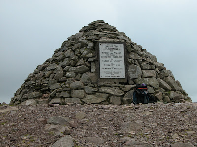
The weather prevented me having a real work out in Wales so I was anxious to get out. Today was ideal. But where to go ? I decided to explore an area which I imagine most people avoid due to it being very wet under foot. The area I chose was the triangle of land within Chetsford Bridge, Lucott Cross and Aldermans Barrow. Rather than just park up and jump over the hedge I decided to make a walk of it. I parked on Dunkery and walked up to the beacon,
then down across to the hedgerow, which I followed to Porlock Post. I continued across Exford Common, across the road and out onto Almsworthy Common. I entered the triangle onto Hurdle Down and followed a path on the NW side of the marsh through shattered conifers to the stream junction. I looked left up the valley towards the road near Aldermans Barrow and remembered that I had once struggled down through those bogs many years ago. I decided to carry on down stream to the bridge. Still having plenty of time on my hands I continued down Chetsford Water. I soon became aware of stags bolving and herds of deer on each side of the valley.

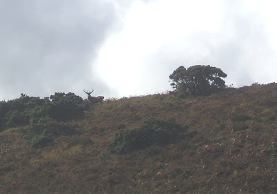
The above stag was on Great Hill on the north side, he did not appear to be very happy, he was shouting at the herd on the other side of the valley.


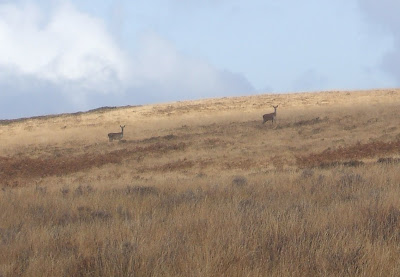
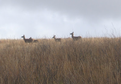
This concentration of deer was one of the largest I had seen. I followed the track as it climbed out of the valley disturbing the herd on the south side as I passed. I soon came out on the road down to Nutscale and turned right towards the road leading to Pool Bridge.
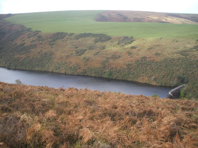
From the road I descended into Dady Combe then up onto Stoke Pero Common then down again into Bagley Combe. As I climbed up onto the Dunkery ridge I noticed another herd of deer on the side of the hill to my left. Soon I was back at the beacon, my legs telling me that I had walked further than I had intended.

Wales.

1st - 5th October 2009.
Mrs Crumbling Cliff and I decided to spend a few days having a look at Mid Wales. We spent the first day in the Elan Valley. It rained, we spent quite a lot of time stumbling around in bogs. When the sun did peek through the views were spectacular with the occasional sighting of a Kite. We managed to find a few Geo caches and eventually got a few miles in. I have never been up on Plynlimon and fully intended to do it this trip but the guide stated that the approach could be boggy so not willing to risk a mutiny in the ranks we gave it a miss and headed north to Cadair Idris.

I last climbed Cadair in 1964 while on an army outward bound course at Towyn. It was part of the final four day expedition. I recall it being a long slog with a very heavy old style Bergen rucksack chaffing my waist and shoulders.


After the rain of the previous two days we had clear but cold weather. I was surprised to find that much of the path is now protected with huge stone slabs. Large bags of these lie around waiting to be laid. We reached the top of Craig Cau where I remembered the heartbreak all those years ago when we realised that it was not the top and that we had to descend then climb again to reach Cadar Idris.

Craig Cau.

We eventually reached the summit. Wainright is correct, this is probably the best mountain in Wales for all round views and we had a cracker, as far as the eye could see. We had lunch, hunted around for the summit geo cache and explored the stone shelter. We then headed off in the general direction of Mynedd Mawr before turning away down the mountain towards the car park at the Idris Estate.

Sillery Sands. Exmoor.

24th September 2009.
Sillery Sands are located down below Countisbury Hill as you descend down into Lynmouth. The easy way down is to park in a layby halfway down Countisbury Hill and descend a zigzag path to the beach. The beach is about a mile in length and divided into three sections, by Higher and Lower Blackhead Points. The three sections are known as Sillery 1, 2 and 3. Sillery 1 is always accessible from the road via the path and steps. The steps are sometimes damaged during violent storms. Access to 2 and 3 is quickly cut off by the incoming tide. Other than by sea there is no escape from 2 and only those with climbing experience can expect to escape from 3 via Great Red and Coddow Slip Gullies. Don't be misled by its name, there is little sand here at the present time, although the shingle is small and not too uncomfortable. I recall there being quite a lot of sand years ago but all that can be found now is at the bottom of the steps, on Sillery 1 at low tide.
I parked up at Barna Barrow Quarry at high water. There would be no chance of gaining normal access to 2 and 3 at this time so I decided to descend Coddow Slip Gully down to 3. This went well. While climbing down the final 300ft of a recent landslip I noticed curious features in the boulders. This slip occurred about five years ago completely filling the bottom of the gully.
I have no idea what these shapes are. I originally considered fossils or ancient seaweed. It has been suggested that it is metallic stains. This is probably correct because as you can see from the photo below, and in the main cliff there is quite a lot of iron ore present.

I moved west past the bottom of Great Red Gully to Higher Blackhead Point where the beach vanished. I climbed a slab onto the top of the point then descended with a final difficult move down onto Sillery 2. Next came Lower Blackhead Point which gives the impression of being a serious undertaking, but it goes easily by following a large ledge at 12ft up around onto Sillery 1.
I returned via the same route to the base of Great Red Gully and slowly made my way with many rests to the top. On my way back up the path to the car I met an elderly couple from Leicester who visit Exmoor twice a year to watch the deer. The gentleman informed me he had been coming down since 1947. Dedication.

The Ivystone. Exmoor

18th August 2009.

Decided to revisit The Ivystone at low water on a spring tide and get a couple of climbs in. Parked up at Worthy Combe gatehouse, descended to the beach via Rockford Cottage and trudged along the beach to the buttress which was well out of the water. I climbed two routes at the right end of the main buttress. One was new, the other is named Channel Chimney. I then ascended the

gully on the west side of the buttress to the main ridge which I then followed up to the disused coast path. Many years ago I recall driving my minivan out past Culbone to this spot and parking in a recess or layby beside the track. I imagine many other people did the same. Just below the track is an axle with two spoked wheels, tyres still fitted. The area was obviously used to dump various bits and pieces. Thankfully only the axle remains visible. Landslips have reduced the width of the track to a narrow path, its no longer possible to drive to The Ivystone. As I walked back via Culbone it dawned on me that the route in around Culbone Combe extends the distance quite considerably back to Worthy Combe, its probably quicker to walk back along the beach.